I know that LoRa tech is capable of impressive line-of-sight distances when there are no obstructions, but as I hadn't had time to pack my HAB gear, I needed to find some other way of testing the range.
The Feather boards are a nice size and I was just using a length of wire as an antenna. Example client/server Arduino code from the Radiohead RFM0x library was good enough for my purposes. Each board would blink its LED when it received a packet so I could see if data was being exchanged.
For the tests, one board stayed back at base in the chalet - shoved out the Velux window for maximum height.


It was very sunny and hot so I decided that the base Feather ought to have some shade.

The second board came along with me on my travels, powered by a battery pack.

Over a few days I took the Feather out with me, first of all just cycling around the town, then for a grander test, heading up the mountain in the Grand Massif tele-cabin.

On the ascent, I was surprised to not be picking up any packets, even though I had been able to get good reception if I wondered about in the car park at the bottom. Thinking that the cabin itself might be acting as a bit of a Faraday cage, I poked the Feather out the window, and immediately started seeing the blinkin' red LED.
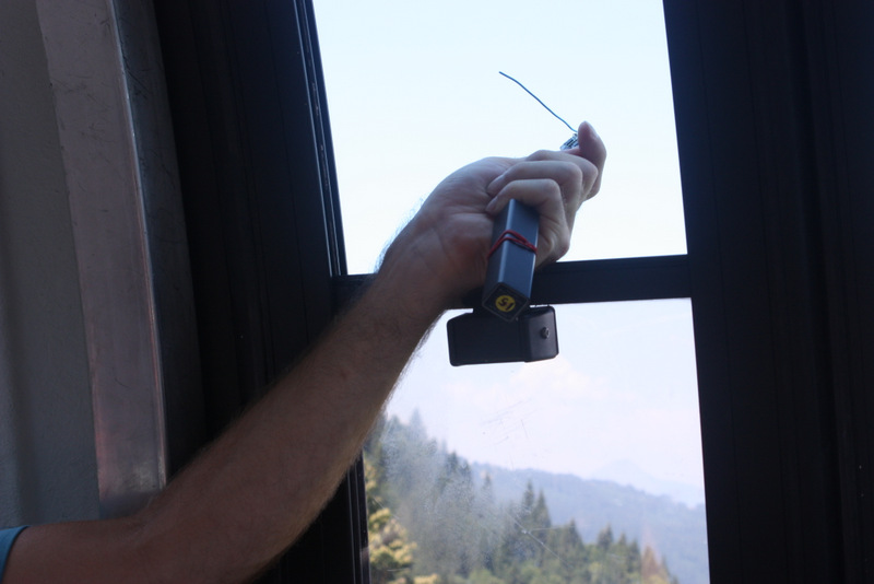
The contours of the mountain meant that there was actually quite a lot of rock and trees in between the two boards right at the top of the tele-cabin, and despite some wandering around to try to get better reception, the LED stayed off until we'd trekked some way further up the mountain.
Fortunately you can also get a chair lift even higher, so we continued to ascend to 2100m (the chalet itself is at 700m).

At the top the signal was very strong and with binoculars we could actually see the chalet down in the valley.
I recorded the various locations using the GPS Waypoint app on my phone and then exported these via KML into Google Earth. Red markers are places where there was no reception, green are where packets could be received.

This allows me to calculate the straight line distance between the two boards - the maximum distance was 5.86km,

Even on flat ground, with trees and buildings in the way, I was still able to exchange packets at 2.60km, and after that point I rounded the edge of the opposite mountain which probably blocked any further data.

So I was very impressed with the boards. They'll certainly be up to relaying data from my new shed....
No comments:
Post a Comment